Connect this guide with the rest of your visit in the Macao trip planner. Read how the research is made and what its sources establish.
At a glance
Start here
- Begin with A-Ma Temple and the sacred meaning of the waterfront.
- Read fortresses as parts of a defended trading port.
- Use archaeological porcelain as material evidence of exchange.
- Compare historic maps and present views because the shoreline changed.
01
The sea organized the old city
The Cultural Affairs Bureau's maritime route describes Macao as a transit port that connected Chinese silk, porcelain and other goods with Japan, India, Southeast Asia, Europe and the Americas. Its historic sites include places of sea-god worship, coastal defence, Christian institutions and cemeteries created through movement along maritime routes. The network is cultural as well as commercial.
UNESCO adds a geographical point: the Historic Centre still has visual relationships with water even though reclamation changed the original coast. A-Ma Temple faces the river to the south, Guia relates to the Outer Harbour, and Mount Fortress retains a western river relationship. Read the city with both the old port logic and the altered modern shoreline in mind.
- Use the official maritime route map to locate the 16 sites.
- Compare heritage topography with the current shoreline.
- Look for religious, defensive and commercial evidence together.
02
Landmark one: A-Ma Temple and seafaring belief
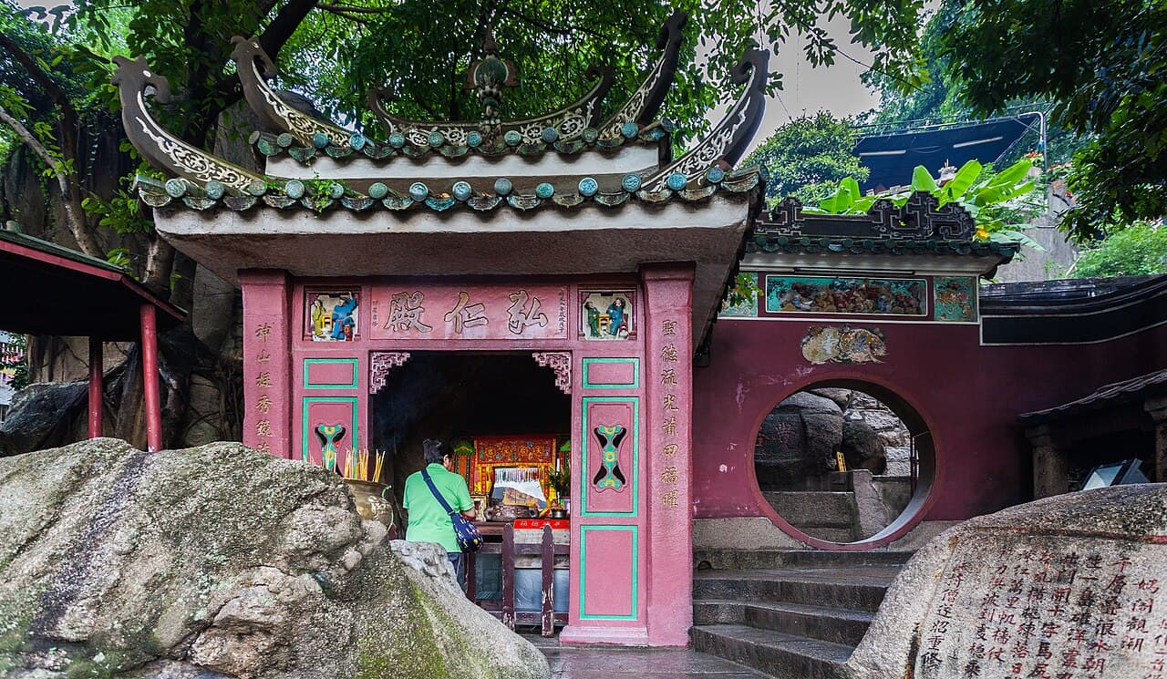
A-Ma Temple existed before the city of Macao developed. Its pavilions occupy the slope of Barra Hill and include spaces dedicated to Tian Hou, also known as the Goddess of Seafarers, alongside other deities and Buddhist elements. The complex makes maritime life visible through religious practice, not through ships or cargo alone.
The temple should be read as an active sacred place. Follow the public route, observe how buildings adapt to rock and elevation, and let current custodial signs control photography and movement. The bay association also appears in the official explanation of the name Macao, though the page presents that origin as a belief rather than an uncontested linguistic fact.
- Notice how the temple climbs the natural slope.
- Distinguish different halls and devotional functions.
- Treat the name-origin account as a documented belief.
03
Landmarks two and three: harbour and fortresses
The Inner Harbour was a principal zone of maritime commerce, with piers and customs-related facilities. The official maritime-trail interpretation of St. Tiago da Barra Fortress explains its position guarding access from the Inner Harbour while supporting the flow of maritime traffic. Defence and trade were therefore two parts of the same port system.
Mount Fortress adds an elevated defensive layer. It was built with the Jesuits and oriented toward threats from the sea, while the St. Paul's complex occupied the neighbouring height. The current city obscures some former sightlines, so use official historical interpretation instead of inventing a complete harbour panorama from today's street level.
- Locate the Inner Harbour before interpreting defensive sites.
- Read fortress position in relation to sea approaches.
- Avoid assuming today's view reproduces the historic coastline.
04
Landmark four: St Paul's and exchange routes
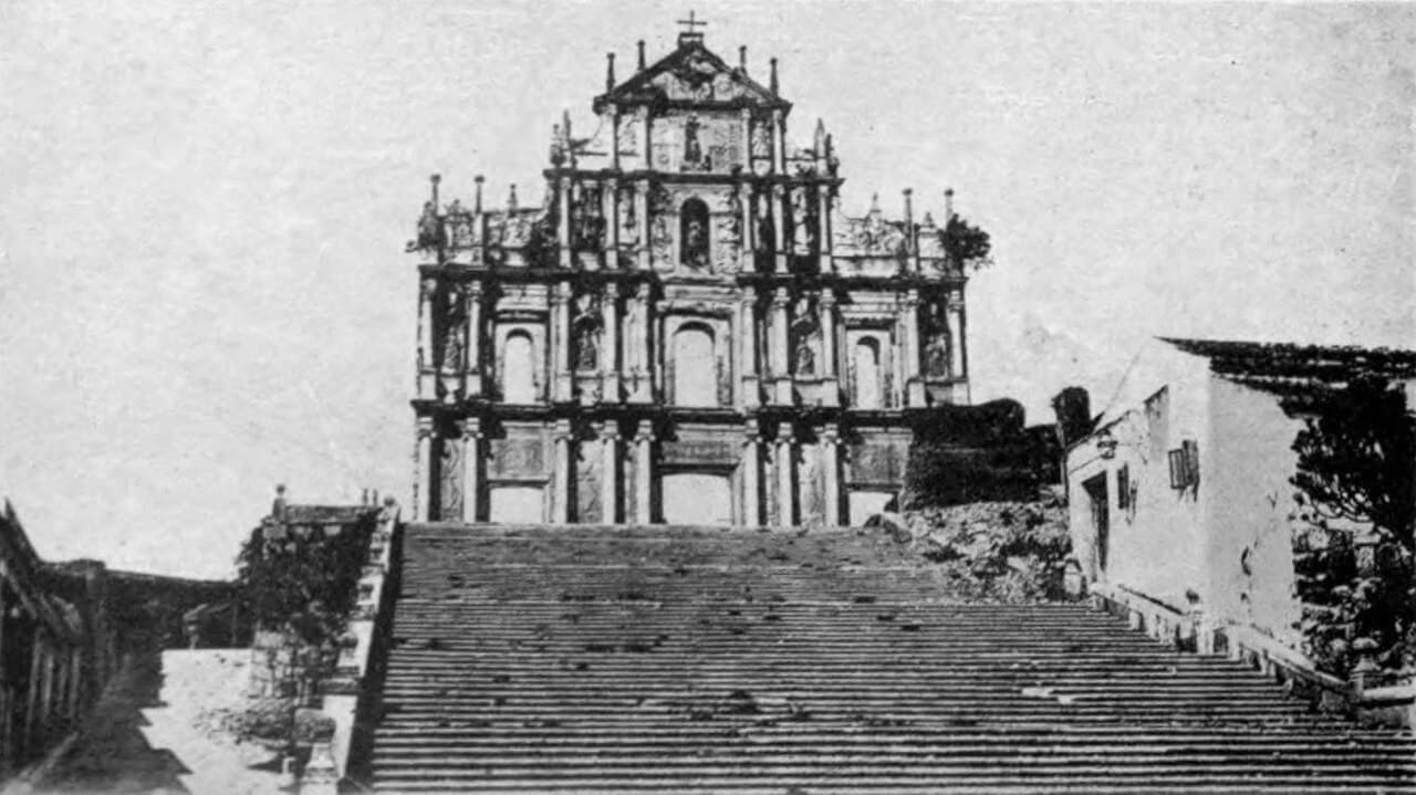
St. Paul's College belonged to a wider web of travel and learning. The official heritage description connects the former college with missionary routes across China, Japan and other parts of the region and with the exchange of scientific, artistic and cultural knowledge. The complex was not a waterfront warehouse, but it depended on the same international networks that sustained the port.
The church façade also contains maritime and Asian imagery, including a Portuguese ship, Chinese characters and motifs from different traditions. Those details make the façade a record of ideas moving with people. Read them alongside the former college's educational programme rather than reducing the site to a symbol of European presence.
- Connect the college to regional movement of people and knowledge.
- Look for maritime and Chinese motifs on the façade.
- Distinguish intellectual exchange from the movement of cargo.
05
Landmark five: porcelain as material evidence
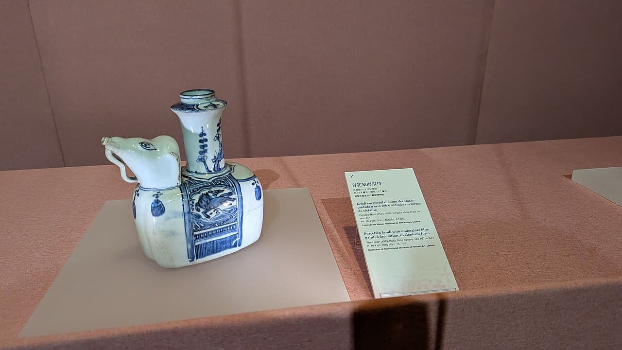
Archaeology near the former St. Paul's College produced large quantities of ceramic and porcelain fragments. The Cultural Affairs Bureau identifies export Kraak porcelain among the finds and relates it to established routes linking Macao with Goa and Lisbon, Nagasaki, and Manila. These objects turn a broad trade narrative into excavated material evidence.
The fragments also challenge the idea that only monumental architecture carries history. An ordinary broken object can reveal production in Jingdezhen, movement through Macao and overseas demand. Use the official site interpretation or Macao Museum displays to understand the archaeological context; do not treat an exposed heritage area as a place to search for or remove material.
- Look for provenance, date and excavation context.
- Connect the object to a documented trade route.
- Leave all archaeological material undisturbed.
06
Landmark six: Guia Lighthouse and sightlines
Guia combines fortress, chapel and lighthouse on the peninsula's high ground. The Cultural Affairs Bureau dates the lighthouse to 1865 and identifies it as the first modern lighthouse on the Chinese coast. Its maritime role is inseparable from elevation, navigation and the wider relationship between the peninsula and Outer Harbour.
The lighthouse is not open to the public, so the story must be read from the permitted fortress and hill areas. Look outward rather than treating the tower as an isolated object. UNESCO specifically identifies visual connections between the heritage property and the seascape as attributes of Macao's old trading-port identity.
- Use permitted public areas to read the wider setting.
- Do not plan on entering the lighthouse.
- Compare the high viewpoint with the changed modern shore.
07
Landmark seven: Maritime Museum as synthesis
The Maritime Museum in Barra gives the scattered landmarks an institutional home. The responsible Marine and Water Bureau maintains the official museum page, while the tourism office describes collections related to southern Chinese fishing traditions, Macao's maritime history and navigation. It belongs at the end or beginning of a Barra-focused interpretation, not as an unrelated indoor stop.
Check current admission and operating information directly before visiting. Inside, use objects and models to test what you observed outside: belief at A-Ma Temple, the harbour's commercial function, navigation, ship technology and the city's changing water edge. Then use the official Maritime Silk Road route to select one additional site rather than trying to cover all 16 in one day.
- Verify current museum arrangements with the authority.
- Connect exhibits to one landmark already seen outside.
- Choose one further maritime-trail site for depth.
Useful answers
Reader questions
Was Macao important on the Maritime Silk Road?
The Cultural Affairs Bureau describes Macao as a major transit port connecting Chinese goods with markets across Asia, Europe and the Americas. Its official maritime heritage route links 16 sites associated with trade, belief, defence and cultural exchange.
Sources: Cultural Affairs Bureau; Cultural Affairs BureauWhat does A-Ma Temple have to do with maritime history?
The temple is associated with Tian Hou, the Goddess of Seafarers, and existed before the city developed. Its religious traditions show how maritime communities understood protection, belief and the waterfront.
Sources: Cultural Affairs BureauCan visitors enter Guia Lighthouse?
No. The official Cultural Affairs Bureau page identifies the lighthouse as not open to the public. Visitors can interpret its maritime setting from permitted areas of Guia Hill and the fortress complex.
Sources: Cultural Affairs BureauWhere should I start a maritime-themed Macao visit?
Start in Barra with A-Ma Temple and the Maritime Museum, after checking current access. Then use the Cultural Affairs Bureau's official maritime route to choose one connected fortress, archaeological or St. Paul's site.
Sources: Cultural Affairs Bureau; Marine and Water Bureau; Cultural Affairs BureauRead the evidence
Sources and further reading
These sources support the relevant sections above. Plans and comparisons are editorial suggestions. Check operators for current arrangements.
- Macao Maritime Silk Road Historic Sites Route ↗Cultural Affairs Bureau · Research date 14 September 2026
Macao's transit-port role and the official 16-site route joining trade, sea-god worship, defence and cultural exchange.
- Historic Centre of Macao ↗UNESCO World Heritage Centre · Research date 14 September 2026
Port-city significance, changed coastline and visual links among heritage hills, harbour and river.
- A-Ma Temple ↗Cultural Affairs Bureau · Research date 14 September 2026
The temple's age, hillside organization, halls, deities and association with seafarers.
- St. Tiago da Barra Fortress ↗Cultural Affairs Bureau · Research date 14 September 2026
Inner Harbour commerce and the fortress's role guarding sea access and maritime traffic.
- Mount Fortress ↗Cultural Affairs Bureau · Research date 14 September 2026
The fortress's Jesuit relationship, defensive purpose and orientation toward maritime threats.
- Ruins of St. Paul's College ↗Cultural Affairs Bureau · Research date 14 September 2026
The college's regional educational exchange and the façade's maritime, Chinese and wider Asian motifs.
- Archaeological Remains of a Bedrock Pit at St. Paul's College ↗Cultural Affairs Bureau · Research date 14 September 2026
Excavated export porcelain and evidence for Macao's documented international trade routes.
- Guia Fortress, Chapel and Lighthouse ↗Cultural Affairs Bureau · Research date 14 September 2026
Lighthouse date and status, its maritime context, and the visitor-access distinction.
- Maritime Museum ↗Marine and Water Bureau · Research date 14 September 2026
Official museum authority, current notices and institutional visitor information.
- Permanent Exhibitions ↗Macao Museum · Research date 14 September 2026
Museum interpretation of international commerce, archaeology and Macao's trading-port development.